
Travel story 7 min read
MyTravelBuddy Stories
Seoul's North Ridge, East to West
Almost everyone walks the Baegak section of the Seoul City Wall from Changuimun, which means climbing 200 metres of staircase in the first kilometre and finishing at a road junction. Walk it the other way and the climb arrives in instalments and the mountain ends in Buam-dong with a coffee.
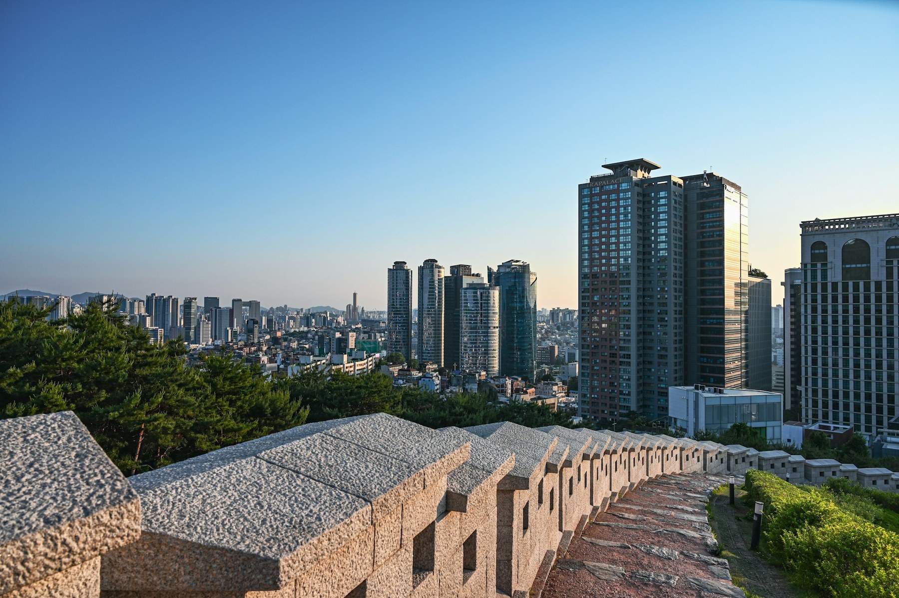
The Seoul City Wall on the Namsan stretch. Photo: Simon Wiedensohler / Unsplash.
Seoul did something most capital cities eventually undo: it kept its mountains. Not on the edge of town, not an hour out by train — inside the old city limits, close enough that you can be on a granite ridge with the skyline under your boots forty minutes after finishing breakfast in a cafe. The fortress wall that the Joseon court threw around the new capital in 1396 is still up there, running over four peaks, and the northern stretch of it is one of the best walks I know in any city of ten million people.
Almost everyone does that northern stretch the same direction, and I think almost everyone does it backwards.
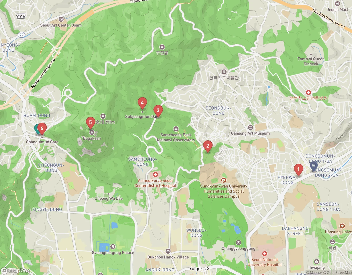
The Baegak section, numbered in the order I'd walk it: 1 Hyehwamun, 2 Waryong Park, 3 Malbawi, 4 Sukjeongmun, 5 Baegakmaru summit, 6 Changuimun. The rail pin is Hansung Univ. Station; the cafe pin is Buam-dong.
Start at the low gate, not the high one
The section is called Baegak, after the mountain most maps now label Bugaksan. It runs between two small gates — Changuimun in the west and Hyehwamun in the east — and it's about five kilometres end to end. Chaining the anchor points on the map above gives 3.5 km in straight lines, which works out around 4.8 km once you allow for how much the ridge path actually wanders. Three hours is a comfortable budget with stops. Two is possible if you don't stop, and you should stop.
The standard advice sends you west to east, starting at Changuimun. Here's why I'd flip it. Changuimun sits at 115 m. The Baegakmaru summit is 316 m. Between them is barely more than a kilometre of map distance, almost all of it staircase. Going that way, you climb two hundred metres in the first twenty minutes, arrive at the best viewpoint on the walk with your heart going, and then spend the rest of the afternoon descending toward a busy road junction.
Go the other way and the same climb arrives in instalments. Hyehwamun is at 56 m. Waryong Park is 158 m. The Malbawi information centre is 187 m, Sukjeongmun 212 m, and only then does the ridge lift you to 316 m. You gain the whole thing across three and a half kilometres instead of one, you're warm before the steep part, and you finish by dropping two hundred metres off the summit into Buam-dong — a small, quiet, slightly arty neighbourhood on the far side of the mountain where the walk ends with coffee instead of a bus stop.
There's a light argument too. Walk east to west in the afternoon and the sun is ahead of you, dropping toward Inwangsan, and the city sits in haze to your left the whole way. Walk the other direction and you spend three hours with it behind your shoulder.
The practical shape of the day
Take Line 4 to Hansung Univ. Station. Hyehwamun gate is about two hundred metres from the exit — this is one of those rare trailheads you can reach without a taxi or a decision. The wall picks up almost immediately and climbs through Seongbuk-dong's back lanes before it commits to the ridge.
From Waryong Park onward you're on the mountain proper: stone steps, wooden steps, more steps, and a parapet of fitted granite blocks beside you nearly the whole way. Watchtowers and gokseong — curved bulges in the wall built out over the slope — give you the viewpoints. Sukjeongmun, the great north gate, is the one everybody photographs; it's also the point where the path stops pretending to be a park and starts being a mountain.
Two things worth knowing before you go:
- Carry your passport. This ridge sits directly behind the old presidential compound and was closed or ID-controlled for decades. Access has loosened a great deal since the trails around Cheong Wa Dae reopened, and on an ordinary day you may well walk through without anyone asking. Carrying ID costs you nothing and is the single cheapest way to avoid being turned around at a checkpoint.
- Daylight is the real cut-off, not the gate. Google's current listing has Changuimun open 07:00–19:00 and the Malbawi entrance from 06:00. Those hours shift seasonally and the mountain gates have historically closed earlier in winter, so check on the day. In practice the constraint is the sun: Seoul's sunset slides from 17:59 on 12 October to 17:40 by the 26th and keeps going. Be on the ridge by early afternoon and you're fine. Start at four and you'll do the best part in the dark.
This is a stairs walk. There is no step-free version of the Baegak section, and no shortcut off the middle of it — once you're past Malbawi you're committed to the far end. If stairs are the problem, the Naksan section is the answer instead: from Dongdaemun up over Naksan to Hyehwamun is about four kilometres on a hill that tops out at 74 m, it's paved, it's lit at night, and it has the same wall.
When to go, and the window I'd pick
Mid-October is the beginning of the good run rather than the peak of it. Seoul's foliage turns later than most people expect, and it needs a cold snap to do it.
The current forecast has one. There's rain around on the 13th, and a genuinely nasty day on the 18th — 87 mm and wind over 20 km/h, which is a day to be in a museum, not on a granite staircase. Behind that front the pattern settles: the 20th through the 26th looks dry, clear and cool, with highs of 13–16°C and overnight lows dropping to 6–8°C. Those nights are what turn the oaks and maples on the ridge. That week is the walk I'd book.
Dress for the gap. A 7°C morning and a 16°C ridge in full sun are two different days, and the wall offers no shade on the exposed sections and no sun at all on the north side.
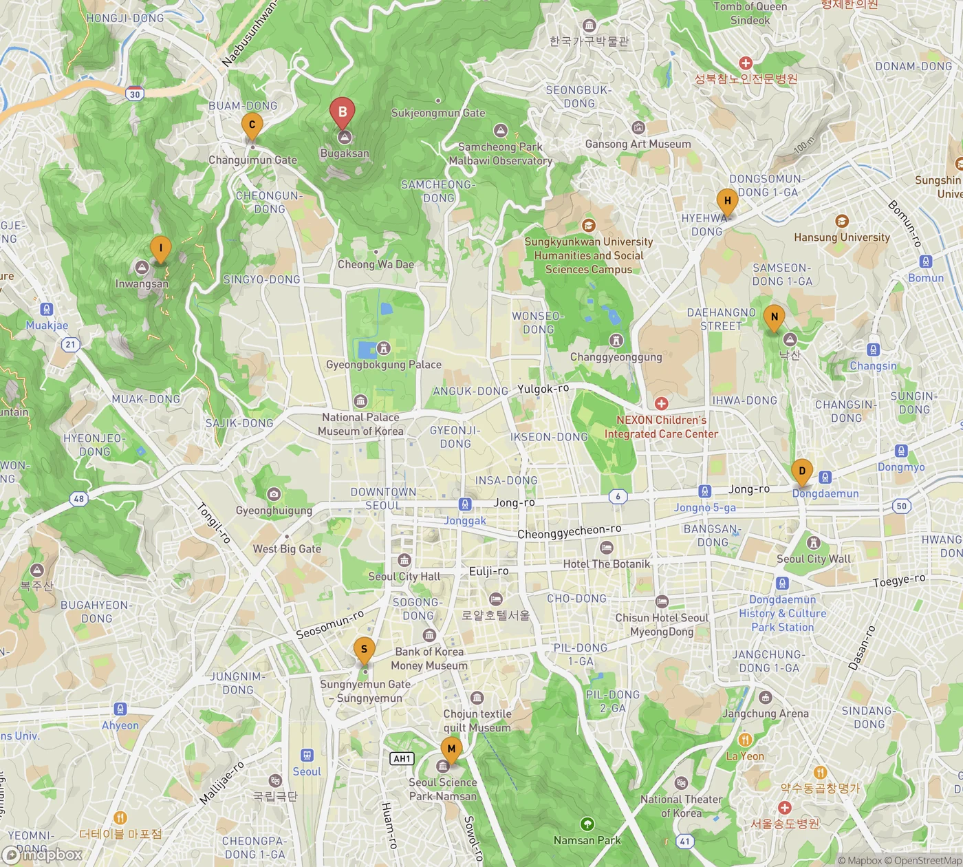
The whole ring, for scale: B Bugaksan, I Inwangsan, N Naksan, M Namsan.
What to skip
Skip the complete circuit. The full wall is roughly 18.6 km over four mountains, and there's a certain kind of visitor who reads that number and decides to do it in a day. You can. You will also see very little of it, arrive at Namsan after dark, and remember the whole thing as a leg workout. The wall was built across four mountains precisely because they're four different places. Give the Baegak ridge an afternoon and let the others wait.
Skip Bugaksan on a public holiday if you have any flexibility. The steps are narrow and the passing places are the viewpoints, which is the worst possible combination.
The end of the walk
Changuimun drops you into Buam-dong, and this is the real reason for walking the mountain this way round. Club Espresso is about two hundred metres from the gate and open 09:00–19:00 daily — old-school, serious about roasting, and entirely unbothered by the fact that you've just come off a mountain. If you'd rather sit somewhere with a view, Sanmotunggi is another seven hundred metres up the lane, open 11:00 until just before eight, and the terrace looks straight back at the ridge you've been standing on.
That's the argument, really. Walk it east to west and the mountain ends in a neighbourhood. Walk it the other way and it ends at a road.
If you want one more hour of it afterwards, the Seoul City Wall Museum sits at the Dongdaemun end of the Naksan section, open 09:00–18:00 and closed Mondays, and it's free. It makes much more sense after you've walked a piece of the thing than before.
Continue wandering
One more story for the road
October 10, 2026 · Maya Roam
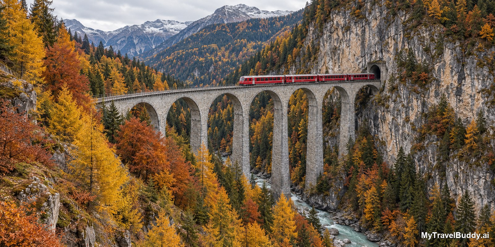
Sixteen Days Without the Landwasser Viaduct
From 29 October to 13 November the Rhaetian Railway closes the Albula line between Thusis and Preda, and the most photographed bridge in the Alps goes silent. What still runs, what the Bernina Express loses, and the dry three-week window that is still open.
Read nextInspired to go?